URBANARU

URBANARU Inc. · AI for architecture and cities

Cities where everyone lives well, built with AI

We use AI to analyze and diagnose buildings, cities and infrastructure, and propose improvements. We design for everyone who lives in the city, including foreign residents, older adults, people with disabilities and children.

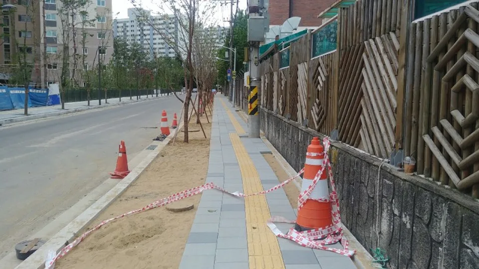
Street with construction materials and traffic cones blocking the sidewalk
NowSidewalk blocked by construction materials
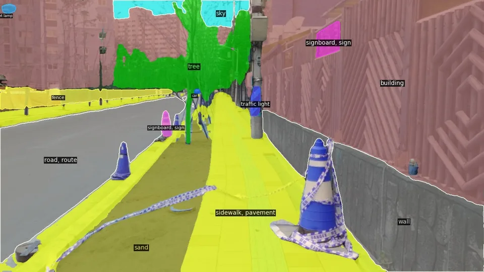
The same street segmented by AI into sidewalk, wall and street objects
AI diagnosisElement recognition and comfort scoring
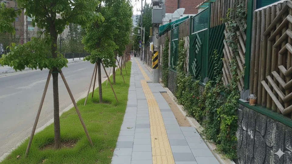
AI-generated improvement with a clear sidewalk and greenery
AI proposalDesign changes that raise comfort

Example output of our street environment diagnosis and improvement AI

What we do

We analyze current conditions, diagnose problems, and stay with you through improvement.

Urban diagnosis and improvement consultingLocal governments, public agencies

We assess comfort, safety and convenience at the neighborhood level using street images and public data, and propose improvements for urban and community plans.

  • Urban plan issue diagnosis
  • Mobility for vulnerable pedestrians
  • Living environments for foreign residents
  • Streetscape analysis

Smart construction and infrastructureBuilders, facility managers

We analyze image and sensor data with AI to assess facility and infrastructure condition and building disaster risk, and propose maintenance and response plans.

  • Facility condition analysis
  • Building disaster risk
  • Maintenance prioritization
  • Infrastructure data

Architecture and engineering servicesCompanies, research institutes

We provide technical advisory and research services in architecture, real estate and engineering, built on AI+BIM design generation and spatial data analysis.

  • AI+BIM design generation
  • Site and housing analysis
  • Public research projects
  • Spatial analysis software

AI solutions

We build technology that connects diagnosis and improvement in one pipeline.

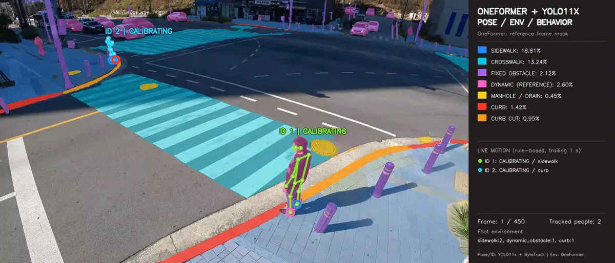
Roadside video with pedestrians, crosswalk and sidewalk detected

Real-time walking environment monitoring

Detects pedestrians and environmental elements in roadside CCTV video, and finds the spots where vulnerable pedestrians such as older adults and people with disabilities struggle.

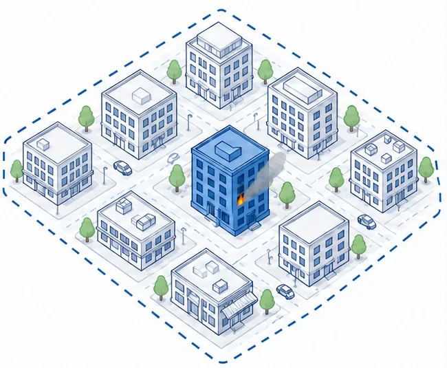
Illustration of a building at fire risk among neighboring buildings

Building disaster risk analysis

Combines each building's vulnerabilities, hourly population exposure and emergency access, and uses AI agents to find the best fire preparedness and response strategy.

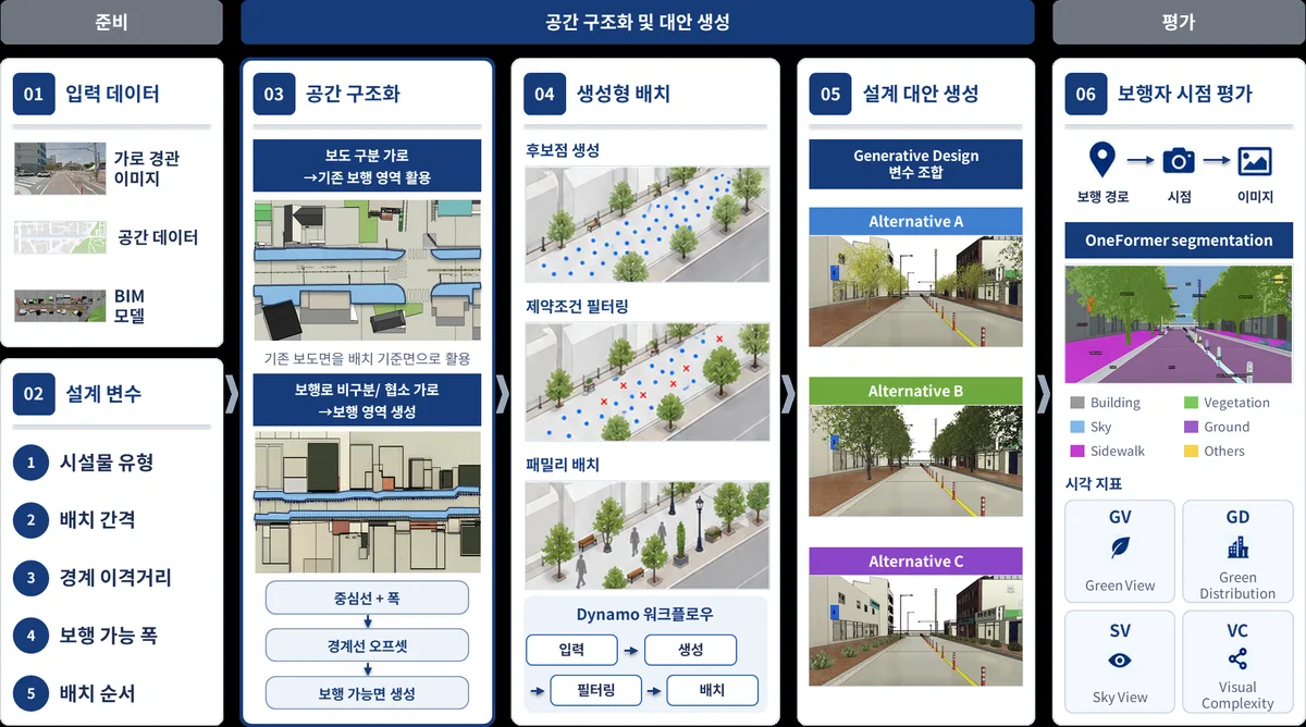
Street design alternatives generated with AI and BIM

AI+BIM design generation

Generates street and space design alternatives from diagnosis results and user experience, and evaluates them from the pedestrian's point of view.

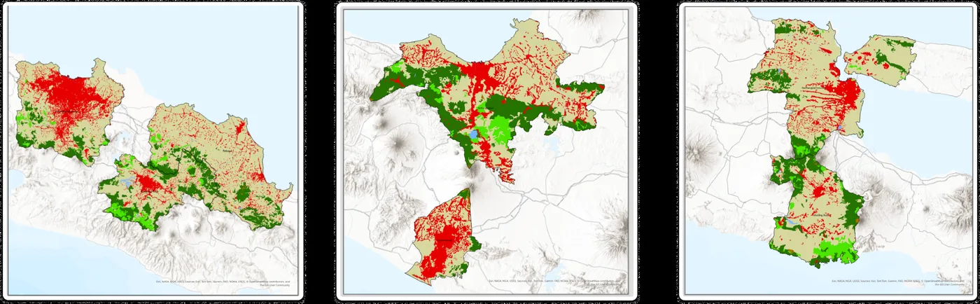
Land cover change maps for 2015 and 2024

Urban change analysis

Estimates changes in land cover and urban heat from satellite and spatial big data, for cities in Korea and abroad.

Product

Urban-FIT

A daily-life information service for foreign residents in Korea, especially international students. Describe your commute, budget and living needs the way you would say them, and Urban-FIT shows the neighborhoods and places that fit you and why. It also takes reports of everyday inconveniences and diagnoses them.

  • FindNeighborhoods and places that suit you, for living and visiting
  • InhabitDiagnosis of neighborhood inconveniences from a space profile of street photos and local information
  • ThriveReports from residents turned into improvements by universities and local governments

It is free for foreign residents. Their reports and ratings feed the neighborhood diagnosis, and contracted universities and local governments receive reports with directions for improvement.
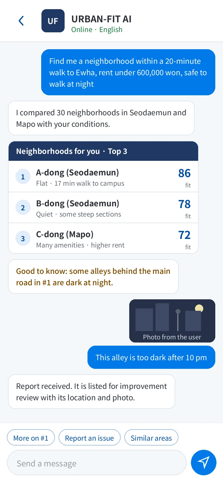
Urban-FIT chat example
User screen (example)
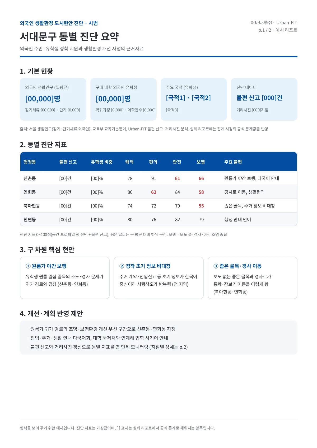
Example neighborhood diagnosis report, in Korean
Report for universities and local governments (example in Korean, illustrative values)
User app / web Foreign residents · living, travel Ask in words or photos Pick points or areas on a map Report issues (photo, place) Query parsing (LLM) where · what · conditions field (living, travel) Results Neighborhoods and places Scores, sources, confidence Report status, directions KO · EN · ID · VI Urban-FIT engine Find taste ↔ space matching Diagnose indicators, everyday issues Improve text and images, suggestions Space profile DB · Seodaemun, Mapo place ⊂ road segment ⊂ 50 m grid ⊂ administrative dong street photos · road width, population, buildings · local info, sights · reviews, reports · results, improvements Ambassadors assigned by admins field photos, checks, reports Reports for contracted partners (next) issue maps and directions by dong for universities, local governments reviews, photos, reports read / write field checks
Prototype: users ask and report in the app; one engine reads the space profile, answers, and links issues to improvement.

Research

We turn technology from urban spatial research into tools that work in the field.

Smart buildings and smart cities for everyone, including the aged and the disabled.The goal of the URI3AN Lab at Ewha Womans University, which URBANARU shares.

Urban and building image analysis

Separates greenery, sidewalks, buildings and facilities in street and site photos. Trained on more than 5,000 street images, each rated for comfort by 50 or more people.

Place perception scoring

Estimates how comfortable and safe people find a place, and explains which elements drive the score.

Spatial data analysis

Combines accessibility, land use and population data to diagnose areas and find places that fit each person.

Our research has been published in international journals including Building and Environment and the Journal of Transport Geography.

Urban Informatics and Intelligent Infrastructure Lab (URI3AN)Ewha Womans University · 이화여자대학교 도시정보지능화연구실urban.ewha.ac.kr

Company

URBANARU is a faculty startup of Ewha Womans University, founded in October 2026. Our CEO, Sungjoo Hwang, is an Associate Professor in the Department of Architectural and Urban Systems Engineering at Ewha. We draw on years of data-driven urban research to find and fix the spatial problems people face every day.

Company
URBANARU Inc. (어바나루 주식회사)
CEO
Sungjoo Hwang
Founded
October 1, 2026
Fields
AI for architecture and cities, smart construction and infrastructure, software development, engineering and architectural services
Address
Room 356, New Engineering Building, Ewha Womans University, 52 Ewhayeodae-gil, Seodaemun-gu, Seoul, Korea

Contact

Email us about urban diagnosis, infrastructure management, research projects or Urban-FIT partnerships.

contact@urbanaru.com